
Description
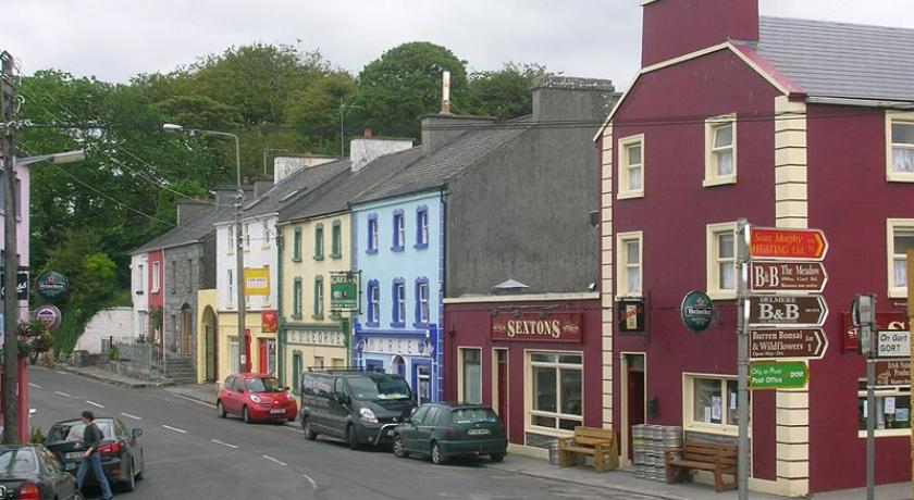
Kinvara (Irish: Cinn Mhara, meaning "head of the sea"), also spelled Kinvarra, is a sea port village located in the south of County Galway, Ireland. It is located in the civil parish of Kinvarradoorus in the north of the barony of Kiltartan. Kinvarra is also a District Electoral Division (DED). In the Catholic Church, the Ecclesiastical parish of Kinvara is part of the Roman Catholic Diocese of Galway, Kilmacduagh and Kilfenora and comprises the civil parishes of, Kinvarradoorus and Killinny (Killina). It is part of the Church of Ireland united Diocese of Limerick and Killaloe.
Kinvara's DED population according to the 2011 Census was 1,351. The Great Famine in the 1840s and a series of emigrations that continued until the 1960s reduced the population of the village – once a thriving port and a significant exporter of corn and seaweed – to no more than a few hundred people. From around the 1980s the population of the parish of Kinvara started to increase while the village started to grow in size.
Geography
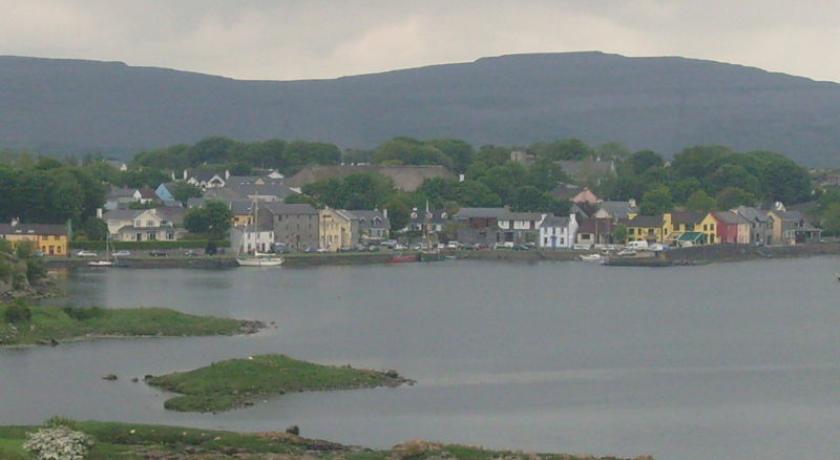
The village lies at the head of Kinvara Bay known in Irish as Cinn Mhara (or more recently Cuan Chinn Mhara) from which the village took its name. This is an inlet in the south-eastern corner of Galway Bay. Kinvara is situated in the territory of Uí Fiachrach Aidhne, which is coextensive with the diocese of Kilmacduagh (Cill Mhic Dhuach). The parish is roughly coextensive with the Ó hEidhin territory of Coill Ua bhFiachrach (wood of the Uí Fhiachrach) and this name was still in use in the mid-19th century as recorded by John O'Donovan in his Ordnance Survey letters. Kinvara is situated in the north of the barony of Kiltartan and close to the border with The Burren in County Clare in the province of Munster. The parish is bounded on the north by Galway Bay, on the east by the parishes of Ballinderreen (Killeenavarra) and Ardrahan, on the south by the parishes of Gort (Kilmacduagh) and Boston (Kilkeedy) and on the west by the parishes of Carron and New Quay (Abbey and Oughtmama).
History
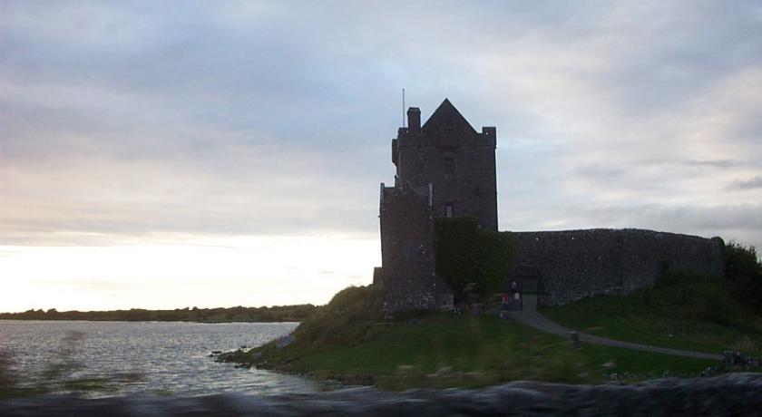
Dunguaire Castle
Dunguaire Castle (Irish: Dún Guaire [lit, the Castle of Guaire]), a towerhouse of the Ó hEidhin (O Hynes) clan, is located to the east of the village. A Fearadhach Ó hEidhin (fferigh Oheyn) is recorded as the owner of the castle in a 1574 list of castles and their owners covering County Galway. This list was thought to have been compiled for the use of the Lord Deputy Sir Henry Sidney who planned the composition of Connacht. Eoghan Mantach Ó hEidhin (Oene Mantagh O'Heine), chief of the clan, is mentioned as the owner of the castle in the Indentures of Composition of 1585.
Terry Alts
The Terry Alt agrarian resistance movement of the early 19th century was active in the Kinvara area. In 1831, a large force of Terry Alts gathered over the border on Abbey Hill between Kinvara and New Quay in County Clare and challenged the English Crown forces to battle. They, however, dispersed before the arrival of the English forces. They also unsuccessfully attempted to ambush a body of English infantry at Corranroo in the west of the parish, which led to the death of one of their members.
Festivals
Kinvara is home every year to two festivals, Fleadh na gCuach ("the cuckoo festival") an Irish music festival at the start of May and the Cruinniú na mBád ("gathering of the boats") in mid August.
Sports
Kinvara is home to Kinvara GAA, a Gaelic Athletic Association club.The club is almost exclusively concerned with hurling but also plays Gaelic Football at Junior level.
Source: https://en.wikipedia.org/wiki/Kinvara
Address
Kinvara
Irlanda
Lat: 53.138908386 - Lng: -8.936296463

